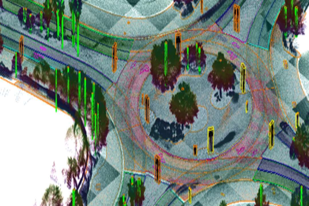
Genesys has announced that its Digital Twin Map platform deployed in Varanasi has been awarded the prestigious GovConnect Award, recognising the platform’s role in advancing urban administration through sophisticated spatial intelligence. The implementation is powered by the Genesys New India Map Stack, a comprehensive mapping ecosystem that strengthens governance, supports infrastructure planning, enables disaster-response readiness, and improves citizen services through the integration of precise location data.
Himanshu Nagpal, Municipal Commissioner of Varanasi, noted that the digital twin platform marks a major shift in how cities can adopt spatial technologies for governance. He said the system is already proving invaluable to Varanasi and that similar solutions will become essential for all urban bodies across the country.
Sajid Malik, Chairman and Managing Director of Genesys International Corporation, stated that the honour highlights India’s growing strengths in advanced mapping technologies. He explained that Genesys is the only Indian company offering a complete digital map stack—from highly accurate geometric twins to predictive systems that combine live and historical information—and that the Varanasi project demonstrates how spatial intelligence can dramatically amplify governance outcomes.
The Digital Twin Map Stack incorporates a highly detailed 3D representation of the city with 5-centimetre accuracy, LiDAR mapping, real-time sensor feeds, navigation-ready base maps, and temporal datasets. The system integrates more than 2,500 CCTV cameras located throughout Varanasi to assist city authorities in managing crowds, especially during religious festivals and cultural events.
Given the city’s proximity to the Ganga and its exposure to seasonal flooding, the platform also supports the identification of flood-prone zones, disaster simulations, and predictive modelling to improve resilience planning. In addition, the system streamlines the oversight and execution of infrastructure projects in a city globally renowned for its heritage and dense, historic urban layout. The recognition marks another step in Genesys’ longstanding contribution to advanced 3D mapping technologies, which continue to gain wider adoption among urban agencies, mobility planners, and infrastructure organisations across India.
Genesys International Corporation Ltd is a leading advanced mapping company with a workforce of more than 2,000 professionals and access to a nationwide constellation of mapping sensors. The company is actively developing the new India map stack and brings deep experience in both enterprise-level and government-oriented mapping applications.