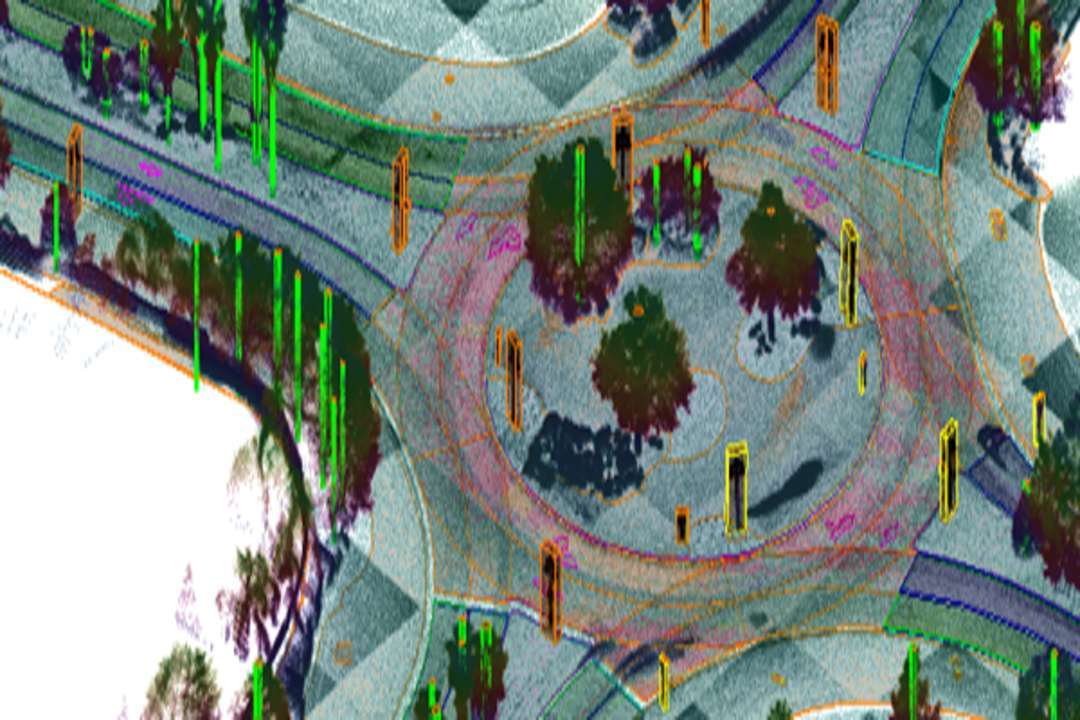
Genesys International Corporation has announced the launch of India’s first large-scale High-Definition (HD) maps designed specifically for ADAS-enabled vehicles, covering more than one lakh kilometres of national highways, expressways, and key transport corridors. Developed as part of the company’s New India Map initiative, the program marks a significant milestone in automotive-grade mapping and road intelligence.
India’s highways carry a disproportionate share of traffic-related fatalities, driven by high speeds, variable driving behaviour, and limited situational awareness. The newly developed HD maps address these challenges by providing centimeter-level detail that goes beyond conventional navigation data. These maps include precise lane geometry, curvature, gradients, road markings, barriers, signage, and localisation references, enabling ADAS systems to anticipate hazards rather than simply respond to them.
To achieve the accuracy required for Level 2 ADAS functionality, Genesys has leveraged the Survey of India’s Continuously Operating Reference Stations (CORS) network, one of the country’s most critical geospatial infrastructures. Real-time GNSS correction data from this network allows survey teams to capture lane-level and asset-level information that meets global automotive standards. The initiative builds on an existing memorandum of understanding between Genesys and the Survey of India, supporting collaboration on national mapping, digital twin development, and high-precision geospatial projects.
The HD datasets, owned by Genesys, are designed for licensing across sectors such as commercial fleet operations, logistics optimisation, mobility platforms, automotive research, and safety analytics. By creating these advanced datasets domestically, the initiative supports the objectives of Atmanirbhar Bharat and strengthens India’s readiness for intelligent transportation systems.
Commenting on the development, Hitesh Makwana, Surveyor General of India, highlighted the importance of high-accuracy geospatial data in modern mobility, governance, and national planning. Sajid Malik, Chairman and Managing Director of Genesys International, said the program lays the foundation for large-scale ADAS adoption in India and positions the country to play a meaningful role in the global shift toward safer and smarter mobility.
Genesys International Corporation Ltd is a leading advanced mapping company with a workforce of more than 2,000 professionals and access to a nationwide constellation of mapping sensors. The company is actively developing the new India map stack and brings deep experience in both enterprise-level and government-oriented mapping applications.