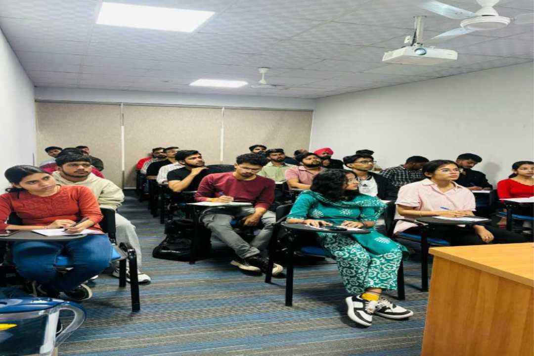
AVPL International, in partnership with Tata STRIVE, is offering a GIS training program at its Drone Skill Centre in Gurugram, aimed at equipping young professionals with cutting-edge skills in Geographic Information Systems (GIS) and drone technology. These technologies are revolutionizing sectors like agriculture, environmental management, urban planning, and disaster response, creating vast career opportunities in India.
Currently, 34 students are undergoing training as part of this initiative. The AVPL International-Tata STRIVE program combines technical GIS and drone skills with soft skills training to develop a workforce that is prepared for the future. To further support these trained professionals, AVPL International has formed a placement alliance with 11 key employers who are seeking GIS specialists, data scientists, urban planners, and drone-enabled GIS monitoring experts.
AVPL International plans to extend its GIS training program to 12 states across India, including Uttar Pradesh, Haryana, Gujarat, and more. In the coming months, training sessions will be conducted through 20 World Incubation Hubs and 50 Drone Aero Vision Labs. This initiative will provide young professionals with the expertise needed in GIS and drone technology, offering them opportunities for high-paying jobs and enhanced career growth.
“GIS and drone technology training isn’t just about gaining a new skill—it’s an opportunity to open doors for career growth and contribute to national development. This is the perfect time for youth to embrace these technologies and turn their career dreams into reality,” said Ms. PreetSandhuu, Founder of AVPL International.
GIS and drone technology are transforming the agriculture sector by enabling more effective crop monitoring, soil analysis, and water resource management. Through the combination of GIS and drones, farmers can gather detailed insights into crop health and soil conditions, leading to more informed decisions. This, in turn, results in improved agricultural productivity and higher yields, contributing to the overall efficiency and sustainability of farming operations.
In disaster management, GIS and drones play a critical role in providing real-time data during emergencies such as floods, droughts, and other natural disasters. By using drones for aerial surveillance and GIS for mapping and analysis, responders can quickly assess damage, identify affected areas, and plan appropriate interventions. These technologies enable more effective disaster response, reducing the time needed to manage the situation and saving lives.
Infrastructure development is another area where GIS and drone technology are making a significant impact. These tools provide highly accurate mapping and monitoring capabilities for projects such as road construction, bridges, and urban development. By using GIS and drones to collect data and track progress, construction teams can ensure that projects are completed on time, within budget, and with the highest standards of quality and safety.
GIS and drones are also playing a key role in urban planning, particularly in the development of smart cities. These technologies help optimize planning systems by providing valuable data that improve traffic management, public transportation, and resource distribution. Additionally, in the mining sector, GIS is crucial for efficient resource management and environmental conservation, allowing for better monitoring of mining activities and minimizing the environmental impact of operations.
As the demand for skilled GIS professionals continues to rise, the growth of industries like renewable energy, urban development, and tourism will provide ample job opportunities. For example, the Global Investors Summit 2025 (GIS 2025) in Madhya Pradesh generated proposals worth ₹22 lakh crore, which are expected to create over 13 lakh jobs, many of which will require GIS expertise.
The growing demand for GIS specialists presents a golden opportunity for youth to establish successful careers in fast-growing fields like agriculture, disaster management, infrastructure development, and smart city projects. With the potential for high-paying roles and long-term career growth, professionals trained in GIS and drone technology are poised for financial stability and success.
Tata STRIVE, an initiative of the Tata Community Initiatives Trust, bridges the gap between vocational education and industry needs. Since its inception in FY 2017-18, Tata STRIVE has focused on providing skill development to youth from underprivileged backgrounds using innovative teaching methods and technologies.
AVPL International, founded in 2016 by Preet Sandhuu and Deep Sihag Sesai, is a global leader in drone technology, precision agriculture, geospatial intelligence, and other drone-based solutions. AVPL operates across 12 Indian states with a network of 50 Global Incubation & Skill Hubs and 20 World Incubation & Skill Hubs. The company’s diverse portfolio includes drone manufacturing, Drone-as-a-Service (DaaS), precision farming, and defense solutions. AVPL has trained over 100,000 professionals and is committed to empowering the workforce through technology and skill development.


